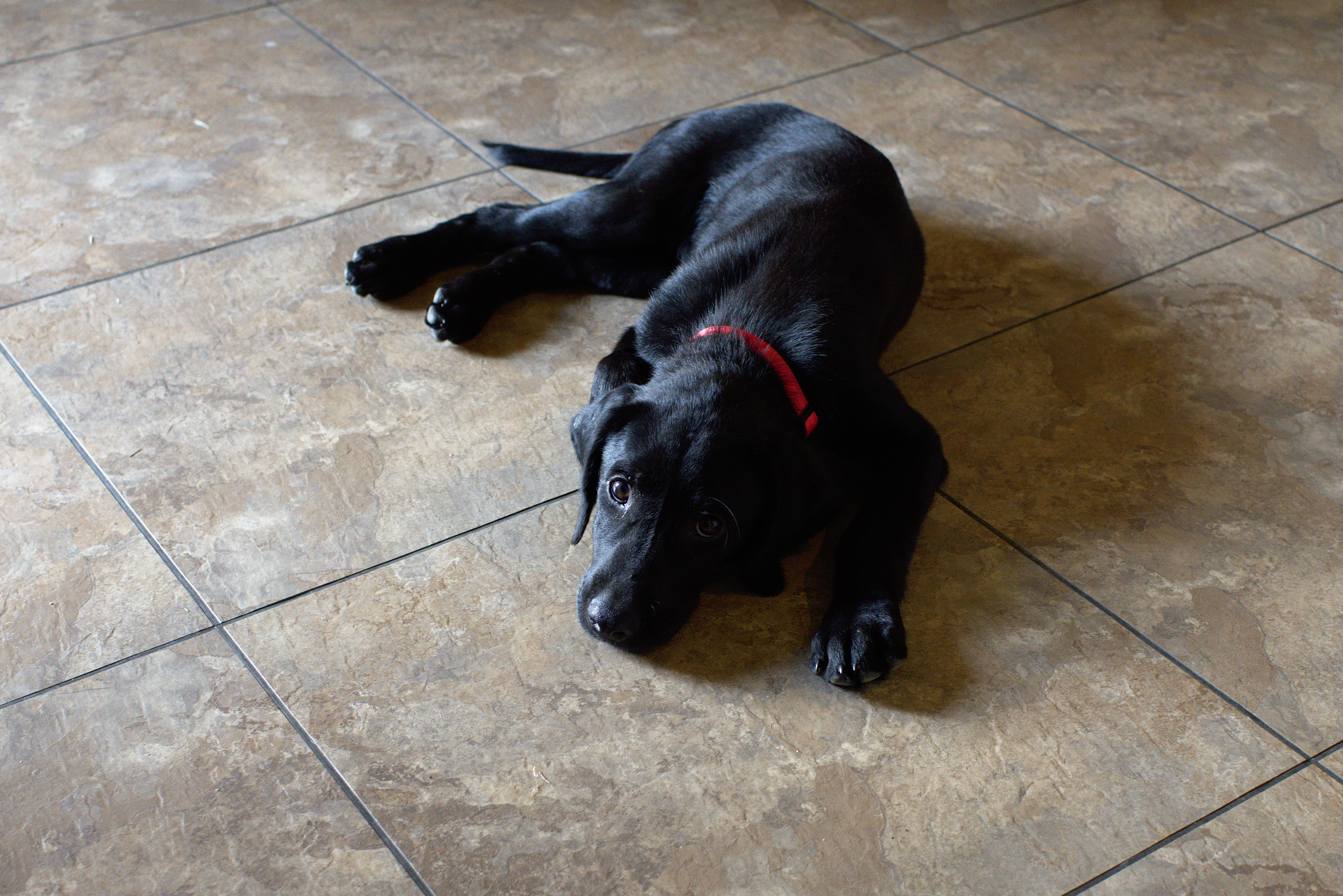
There’s a reason, a very good reason that I’ve been quiescent of late. It’s called a puppy.
Finn Macheiul, our what looks like a purebred Labrador Retriever, was dropped off on the dirt road by our house. (actually he and his brother were.)
You can’t, well I couldn’t, resist that expression.
More to the point, when we took him to the local vet’s, and asked if we should leave contact information, the vet said, “He’s yours.”
Fortunately our older dog likes having another animal around the place. That said, it is a great deal of work training a young dog. Still, he’s healthy, happy, and friendly.
Finn and his brother Tickee playing (Finn has the red collar)
Now back to writing (We have the finish of Regency spies and a new SF series to get out.)
After turning inland we headed to Sonoma – where I forgot to take pictures as it looks much like any other small California town, and we were focused on wine tasting. It used to be free, but isn’t any longer so pick a winery and do a ‘vertical’ tasting. We stayed at the Sonoma Creek Inn, which is the last remaining building from the old hot springs complex. I’d recommend it both in terms of quality and price over the main part of town. (A thousand dollars a night at some of the motels there – which is way way way outside of my comfort zone).
Then we headed down to route 101 and up route 1 to Point Reyes National Seashore. After stopping at the park center to pick up a good map, we headed to Abbott’s lagoon before going to our rental cottage.
We also picked up food. A warning is in order here. There are several small markets along the inner bay in Inverness. Avoid them. The Palace Market in Point Reyes Station is the only one that’s reasonable -both in cost and selection.
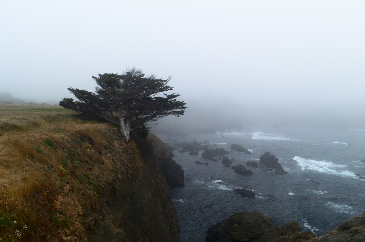
The dunes and beach beyond the lagoon were closed to allow shorebirds to nest and raise their young. Totally laudable, and later we walked to the beach farther North. These pictures are uncommonly sunny – usually the coast is socked in with fog this time of year. More like this view from Drakes’ cliff
After a couple of days exploring San Francisco, we decided to explore further north. Unfortunately, the next few days were predicted to be hot – 110F 38C – in the internal valley so we changed our plans. No lollygagging about in the Napa valley.
Instead we headed to the coast, up to Fort Bragg. It’s a bit of a drive, up the 101 and then over on the 20, but we could stop in Jackson State Forest and explore the redwoods.
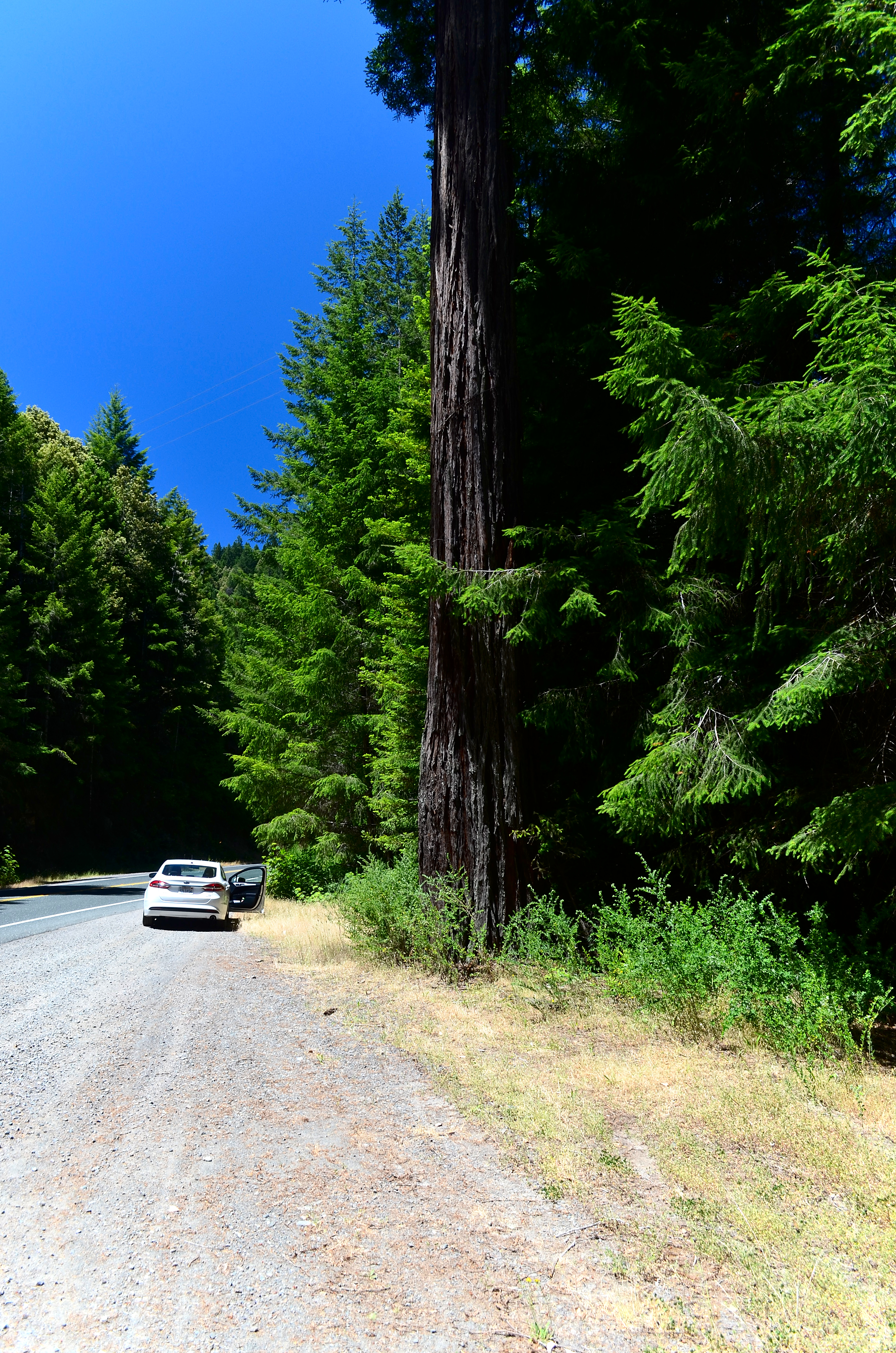
A surviving redwood, with our rental car for scale
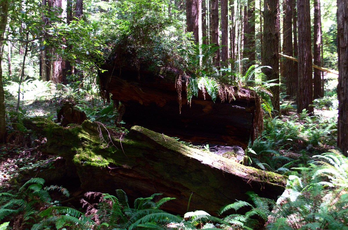
We stopped at a rest area for lunch where there were logging artefacts and some of the worst pit toilets that I’ve seen. The redwoods that have regrown form circles about the one that was removed. Many of the trees that return aren’t redwoods, but douglas firs, so we’ve done a great deal of damage.
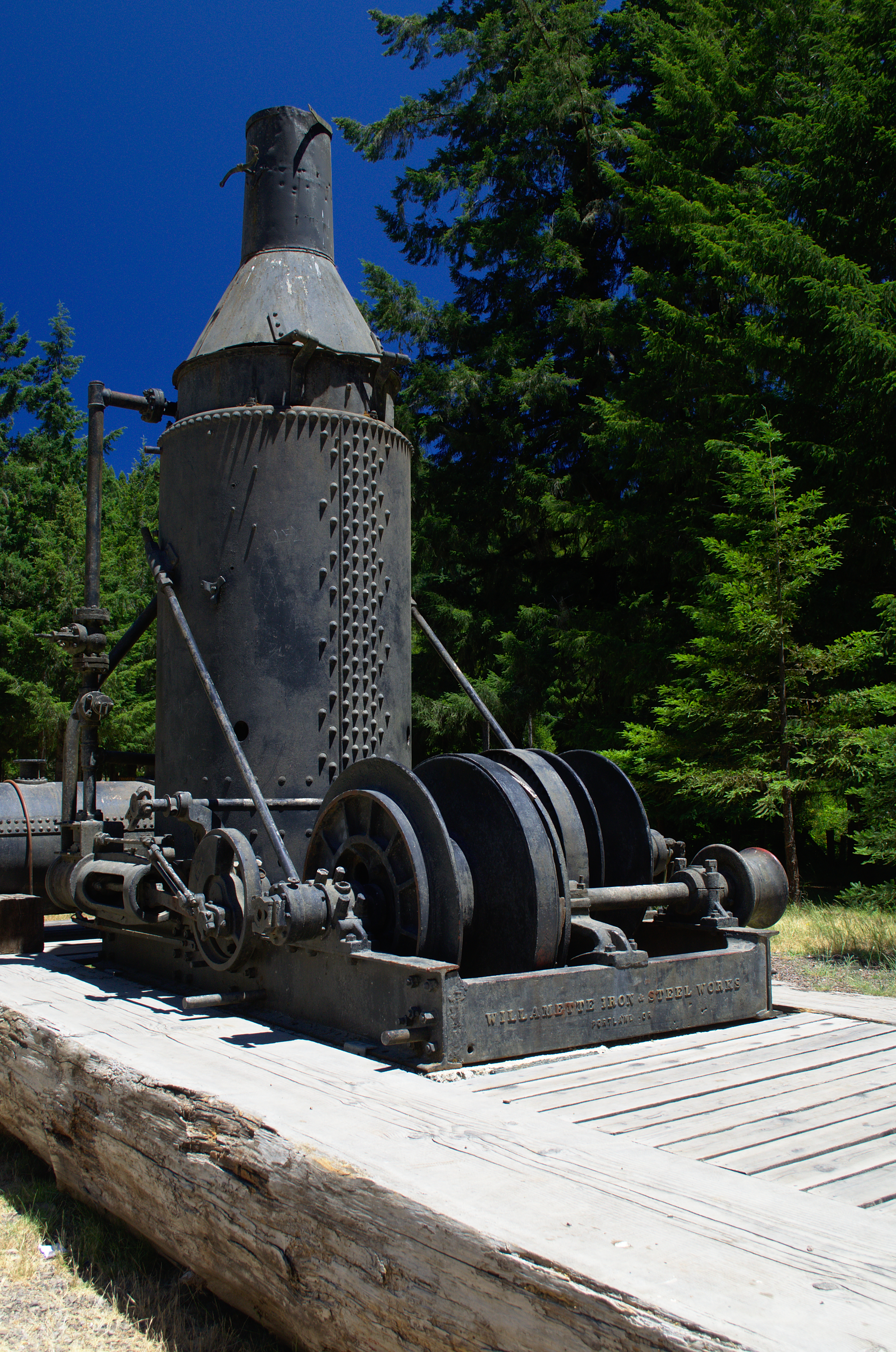
A logging steam engines from the 1920’s.The road to Camp One
Camp One is a right turn, most of the way to Fort Bragg. You follow a winding dirt road back to a parking lot. There’s a short (1 mile) and long (3 miles) loop up the valley. We took the longer loop to stretch our legs. It’s a bit of a climb on freshly cut trails, but well worth it. The header image shows one of the redwood stumps from this walk.
Regrowing Redwood ForestThe Harbor, on the way up after dinner. Django’s is strait in front of us
Fort Bragg is nothing much to speak of. We stayed at the Hotel 6, which had the dual advantage of being the least expensive motel and an open room. It was a choice between eating at a glorified fast food place or going for a walk. We, of course, chose the walk and found Fort Bragg harbor to the south. Live music echoed up and we made our way to “Django’s Rough Bar” for some excellent sea food, live jazz, and good beer. It’s named for Django Reinhart, the two fingered guitar maestro and the rough bar at the harbor mouth.
Angry Bastard, an excellent bitter
The next day we’d head down route 1, stopping along the way at the Jug Handle State Nature Preserve and Point Cabrillo. But more on that later.
Another digression, between Monterey (we actually stayed in Marina, but more on that in another post) and Santa Cruz, we visited the Elkhorn Slough State Wildlife Refuge. It’s a great place for birds, in November through early spring, but less so in summer. Still we counted about 15 species, including a couple of new ones for the life list, so I’m not complaining. Rather I’m thinking of an excuse to visit at a better time.
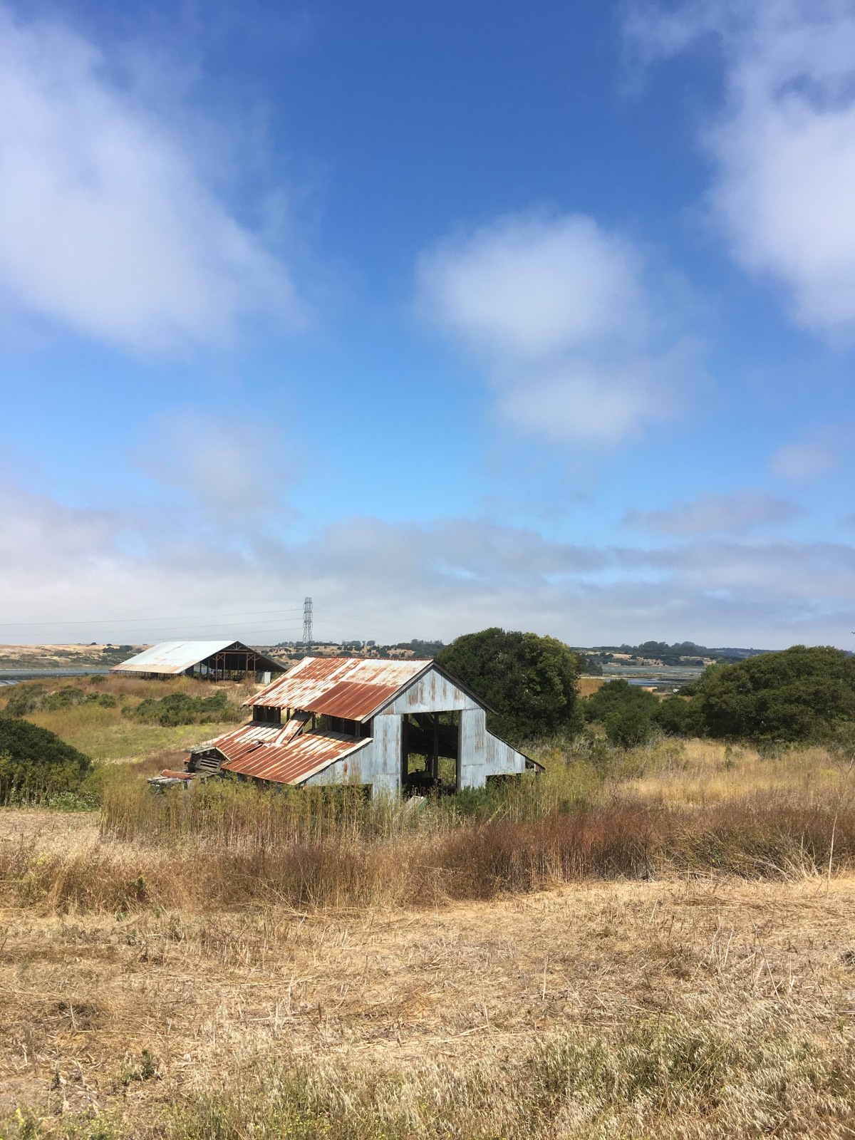
The Center building itself. It wasn’t this nice when I visited about 8 years ago.
The refuge, an old farm, is maintained by the state and in great shape. They will lend you excellent binocculars (Eagle optics), and the rangers are friendly, helpful, and knowledgeable.
A view of the slough from the South Marsh loop
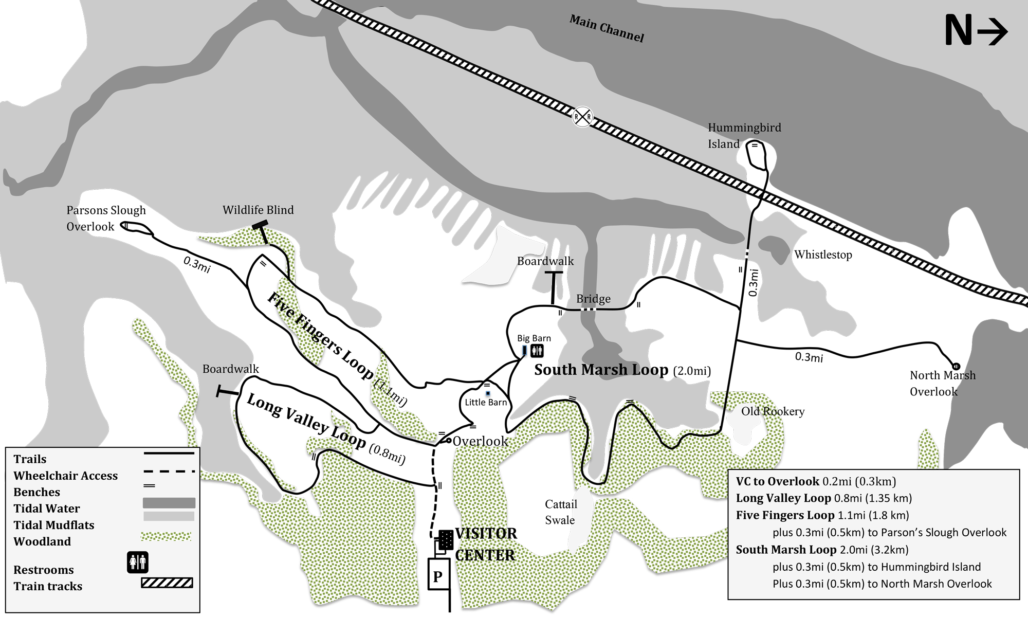
There are about 5 miles of looped trails over a range of habitat. However, it’s mostly slough, mudflat, and open fields with some oak woods mixed in.
A copy of the trail map that they hand out at the center.
Speaking of oaks, California is in the midst of a slow crisis of sudden death oak fungus, so it’s important to clean your shoes when traipsing about. They also had us brush off any possible seeds from invasive species. Poison oak isn’t an invasive species, and it is present in the refuge (the birds love the berries). One interesting difference between the western variety and its relatives in Georgia is that the California poison oak was already turning red and losing leaves. Still you should be careful about it – unless you like itchy patches of blisters. (Using soap and water within an hour or so of exposure is usually enough to remove the oils.)
Burning off Eucalyptis
However at this time of the year, the non-avian wildlife is worth a serious look. In addition to lizards (mostly fence lizards) and a gopher snake that stayed put for an intimate photograph, there were rabbits, seals, and sea otters. Sea otters!
A curious Gopher Snake.
I repeat sea otters. At least two of them (both surfaced at the same time) and possibly three of them. There is a power line that crosses over the Parson’s Slough overlook. An Egret rookery is at the far side of the slough where it crosses. The sea otters were playing in the incoming tide more or less directly under the wire. There was also a curious seal, who would poke his nose up, now and then. I have to admit I didn’t believe that sea otters came in the sloughs, but I was wrong and the ranger was right.
Our day started out sunny, but then the fog and chill (54F, 12C) rolled in, hence the fairly grey photos.
I’ve been trying with various degrees of failure to establish myself as an indie-author. Hence all the literary pointers and similar cruft. Meanwhile, as they say, I’ve had a camera in front of my face since the dark ages (when you processed your own film and made your own prints (and mixed your own chemicals, yum.)) It seems that my photographic and travel posts are the most popular. So that’s what I’m doing as part of a massive re-branding. (At least I don’t have to wait for the iron to get red hot.)
Something of a digression, but we just walked the Tomales point trail at Point Reyes National Seashore through the Tule Elk preserve. This species of elk was nearly hunted to extinction and reintroduced to park about 40 years ago.
Fine, neat, but so what.
Most of the hikers on the trail, and there were more than we’ve seen on any other trail in the park, missed the elk completely. We saw at least 21 and possibly as many as 26 (there was a large herd that was hard to count, my best estimate was 20). There’s a trick to it, well two tricks actually:
Skill and knowledge
Patience
The first step is to find the elk. Being prey animals, even though they’re the size of small cows, they tend to hide away. We saw three heads on the top of a ridge in the distance. Were they elk? Well, out with the binoculars. Yup, elk.
Further on, to get out of the wind (Tulome trail is very windy. The Park Service quietly understates ‘even experienced hikers may find it difficult’.) we took a diversion to hide behind a pile of rocks. There was a small cluster of similar little dots in the distance. Again, out with the binoculars and quelle surprise, a herd of elk, not 100 meters from the path.
Elk as little dots in the distance.
So then it was just a matter of walking to the closest point on the path and waiting. While a fair number of people walked past, chatting about this and that, we watched the elk.
Elk backs with the Pacific Ocean behind them.
At first, they were blobs in the distance.
They walked closer and soon our patience was rewarded. People kept walking past without noticing the animals. Shame.
Two elk
These pictures were made with a 200mm lens, which isn’t a particularly powerful telephoto lens.
We decided to try exploring the West coast for a number of reasons. The most pressing being to see how the trees I planted while working for the city of Salinas were doing. Well, not really, but it’s been a while and, quite frankly, we wanted to see somewhere we haven’t been recently.
We started off by flying into San Jose, which is a smaller airport than SFO, but has the advantage of being much easier to get away from. We booked a couple of nights in Antioch – near the end of the BART yellow line with plans of exploring the city. (FYI we stayed at America’s Best Value Inns there which is cheap, clean, and decent. Hazel’s drive in, just down the road, is a fantastic little restaurant if you’re in the area (bring cash – they don’t take credit cards).) If you do this, it turns out there’s no parking to speak of at the Antioch station. Drive to Pittsburg Bay Center and park there. (You also avoid a transfer).
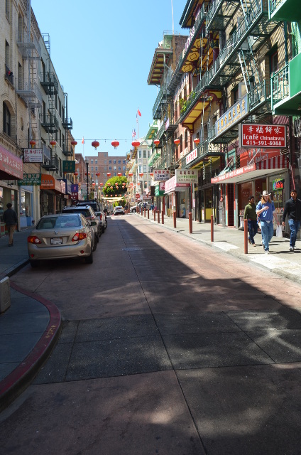
A street in Chinatown.
We explored Chinatown and had excellent dim sum at the Imperial Inn before walking to Telegraph Hill (the Coit Tower then pier 51). The trick to finding good dim sum is to look at the clientele. If they’re mostly Chinese, you’ve found the right place. We picked up salted plums and various Chinese candies that aren’t easy to find in Atlanta. If you walk a few streets West of the tourist area, you can find the Chinese grocery shops. There English is a scarce commodity, but the vegetables and fruits are authentic. There’s also a tension between the mainland and Taiwanese Chinese. Several of the buildings pointedly had either the PRC or Taiwan flag displayed.
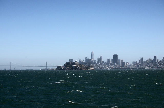
Unfortunately the heat followed us, it being 85-90F (30-32) instead of the more normal 60F (16). So we decided the best thing to do the next day (with inland forecasts of 35-38 (100-108) was to take the ferry. We started at the SFO ferry terminal (near the Embarcadero BART stop) and took the ferry to Sausalito.
The natives posed for a practice shot with my mirror lens. It’s OK, but the resolution isn’t up to my normal standards.
The ferry ride costs about $6.50 each way (use a clipper card, and keep track of your balance). It’s the cheapest way. There’s a bike over the bridge and return on the ferry route that looks fun, but you have to be prepared for it. (We weren’t.) Sausalito is a bit of a tourist trap, so we walked around and admired the yachts. Most of the yachts weren’t being used, and some could be had quite cheaply – if you don’t count the work you’ll need to put in to make her seaworthy.
Sailing by the Golden Gate
The yachts are entrancing, but I’d need a lot of practice to move up from a sailing canoe to one of these.
The top of G-deck turned out to be a good decision. There were a few other people there, but nothing like the crowds in Woodruff park (where I understand fights broke out over viewing equipment.)
I used a regular photographic tripod, which is decidedly sup-optimal for astronomy, but good enough for this purpose.
You can see how the shadow appears to roll over the sun in the sequence below.
I ordered a solar filter for my long lense. It looks something like a very fragile and expensive piece of tinfoil, but works.
Even with that filter, getting the exposure correct can be a bugger. I ended up in manual mode 1/4000 s f29 iso2000. The featured image shows the results, and, yes, those dots in the middle of the sun are sunspots. So we’re ready to go. I’ll probably play around a bit with the film speed to reduce noise, but this is decent enough to work. I’ll use a tripod tomorrow and be at the top of G-deck.
If you don’t adjust the exposure, the sun is completely washed out. Not at all what you want.

 Finn Macheiul, our what looks like a purebred Labrador Retriever, was dropped off on the dirt road by our house. (actually he and his brother were.)
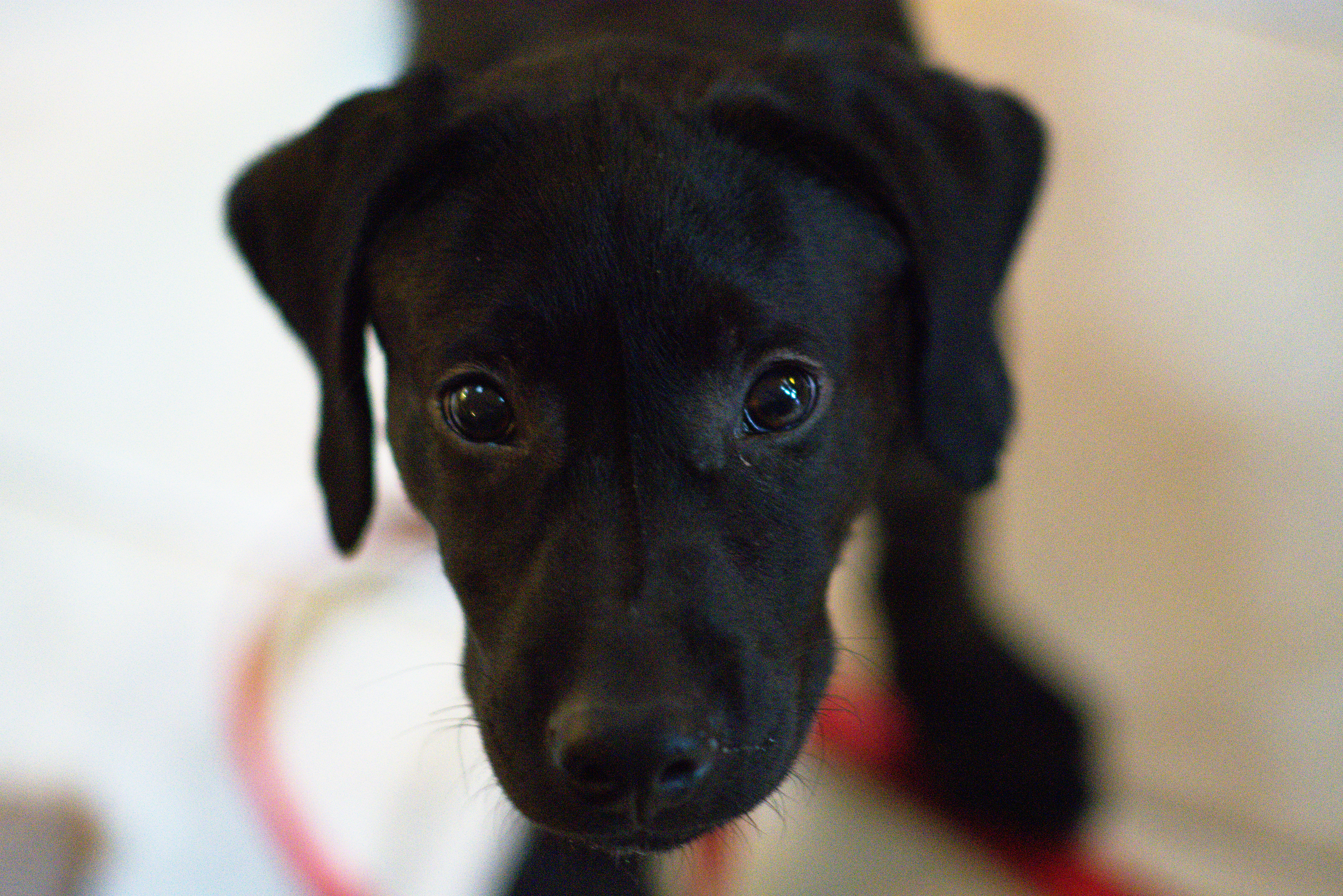 More to the point, when we took him to the local vet’s, and asked if we should leave contact information, the vet said, “He’s yours.”
 That said, it is a great deal of work training a young dog. Still, he’s healthy, happy, and friendly.