Bon Secour NWR

A follow up to my post on RVs. 

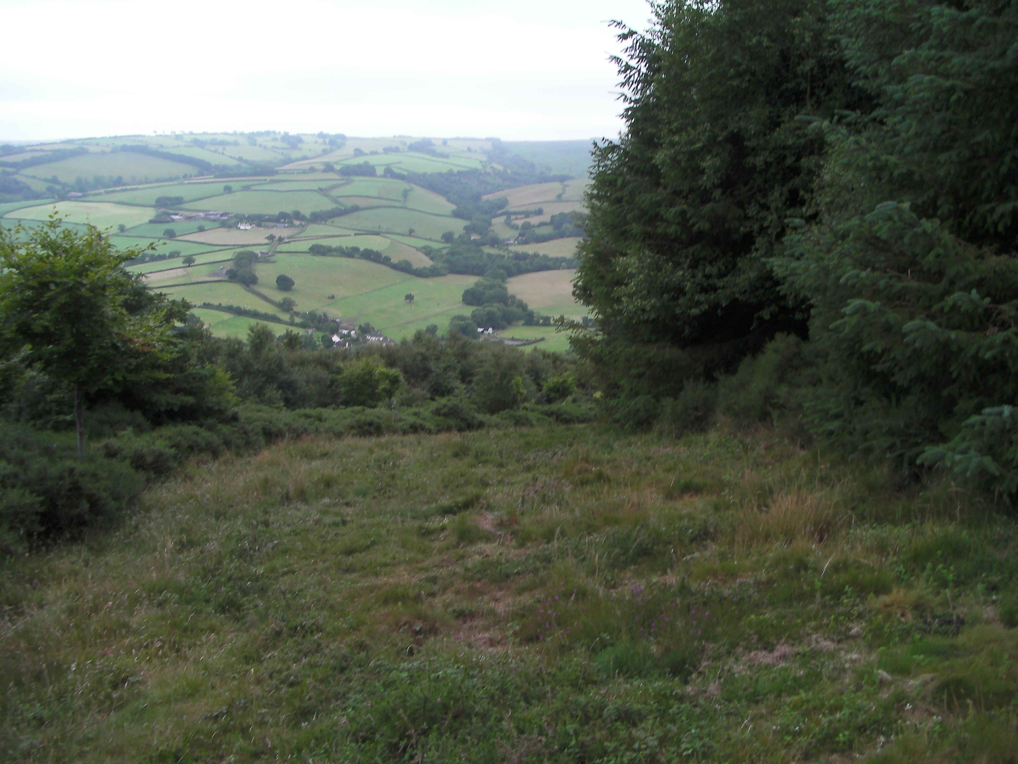
One of the highlights of our trip was exploring the nearby National Wildlife Refuge. We were about a mile down the road from it, and while route 180 is fast, there are wide margins so that it is eminantly walkable.

X marks the approximate location of Fort Morgan RV park.

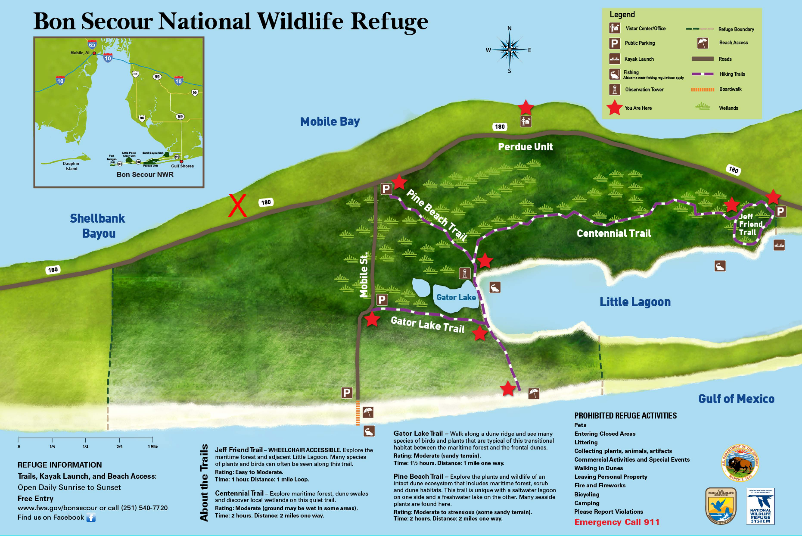
I have a birding life list into the hundreds and was still able to identify five new species without serious birding. (Just walking with binocculars in hand.)  We walked there three times: first, late in the afternoon to the junction of the Gator Lake trail and the Pine Branch trail (4 miles round trip),  second, to the shore on the Pine Branch trail (6 miles round trip), and lastly to the Gator Lake trail returning via Mobile street, the shore, and the Pine Branch trail (8 miles round trip).


A Sandriling

Since pets (dogs) are not allowed in the refuge and there are not that many people who visit, the birds are quite tame. The Sandriling walked within two feet of me.

Fifteen inches (1/3 meter) of rain will flood the trails.

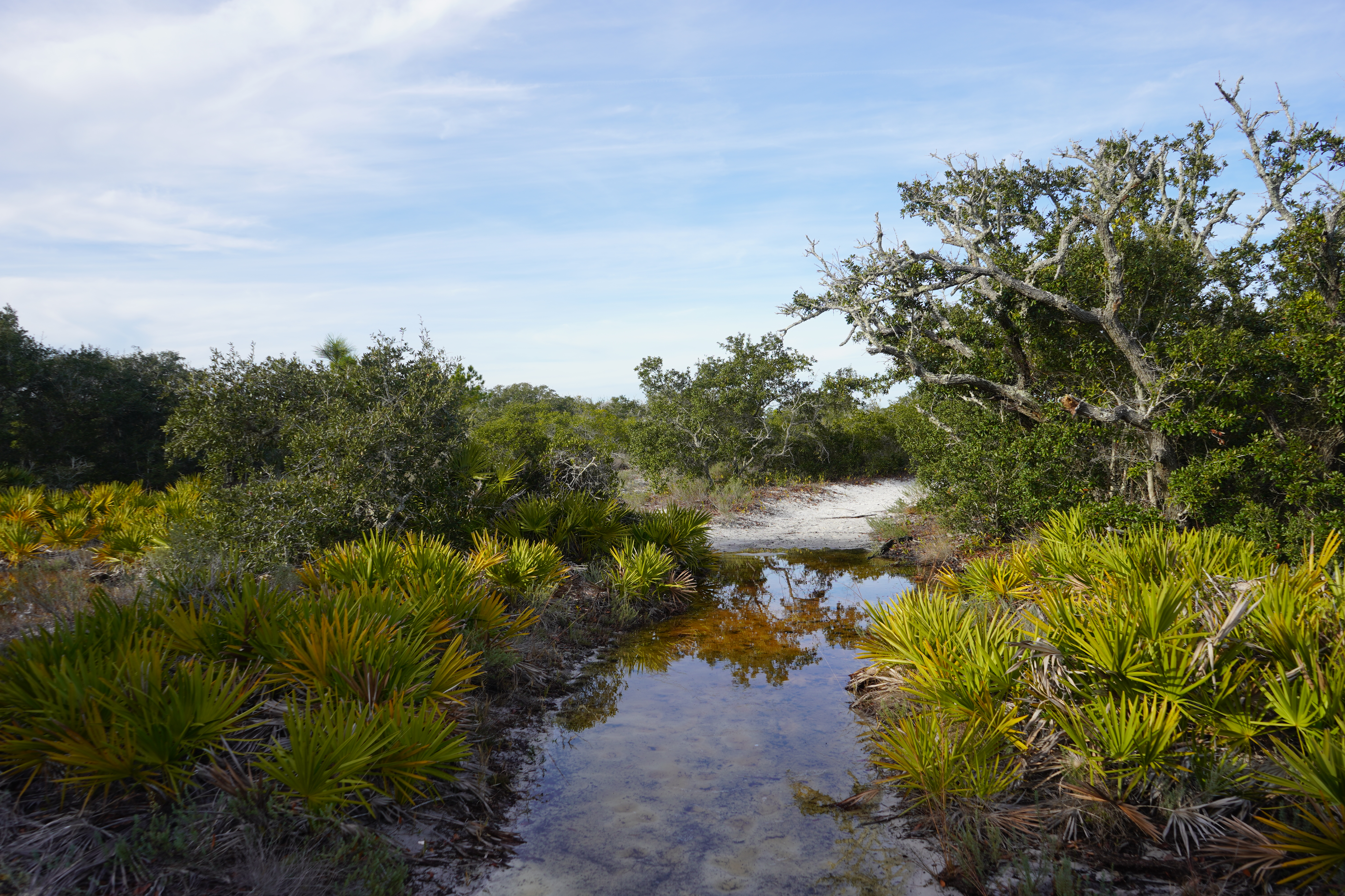
There were mosquitos, even at the winter solstice, so a summer visit should include insect repellent and quite possibly a face net.

Without trying, we saw:

  • Osprey
  • Great Blue Heron
  • Belted Kingfisher
  • Brown Pelican
  • Sandriling
  • Snowy Plover
  • Willet
  • Common Loon
  • Horned Grebe
  • Double Crested Cormorant
  • Lesser Scaup
  • Common Goldeneye
  • Bufflehead
  • White-eyed Vireo

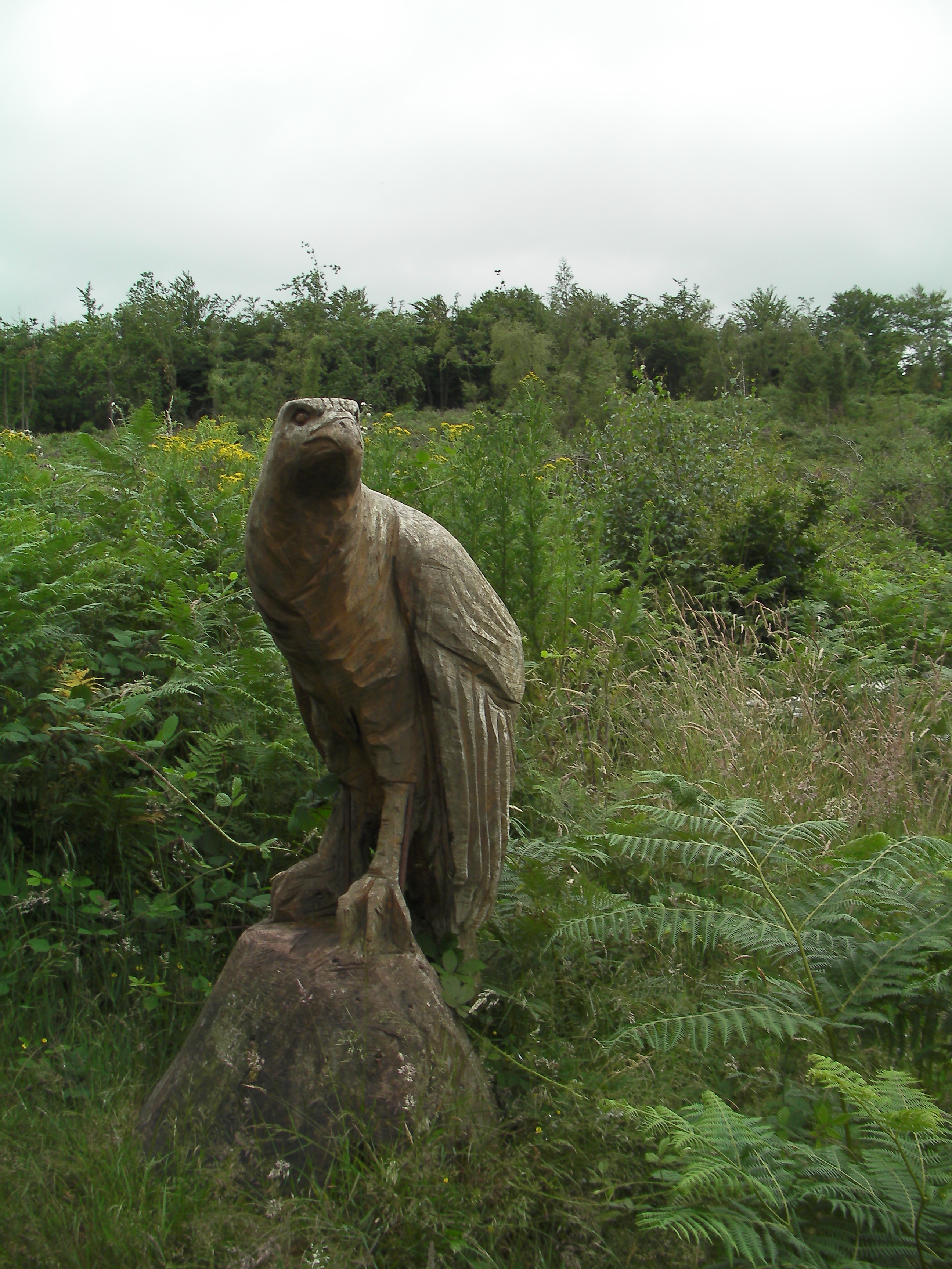
There were gulls (of course) and crows, as well as several varieties of sparrow, that we didn’t identify.  Not to mention these guys, who scared off the plover.

The Blue Angels.

Dunster Loop #Exmoor #UKwalks

I’ve been queuing up a series of walks – mostly about 10 km (6 miles for us colonials), and this is the second.

This started out as a “pub walk” from the house we hired in Wootton Courtenay – and we did get to one, about seven miles in. After several missed turns and places where the map … deviated from the trails on the ground.

This shows our GPS trace overlaid on the most current Ordinance Survey map. These differences made it a bit interesting.

I covered the first part of the hike on an earlier post where we hunted a local pub. So you can read that post for details. We take this walk up at the village of Timberscombe.

Saint Petrock’s church in Timberscombe

We headed uphill on the wrong road, but eventually found our way to where we could see Dunster in the distance.

Dunster’s there, somewhere.

If you get to this carved bird (the buzzard), you’ve gone too far.

Some of the local landmarks have a decidedly sci-fi name. Is Gallox bridge in Gallifrey?

Gallox Bridge
Inside the Stag.

We stopped in the Stag – which is an excellent pub – and let two sweaty, dirty, and tired hikers enjoy their pints inside. It had a guitar in the corner so if you were a better player than I am, you could entertain the crowds (or if you were a better runner you might escape the disapprobriation.)


The path heads uphill, of course, from the town. It winds its way past St. Leonard’s well (Shades of Blackadder) along a ridge.

St Leonard’s well. Locked, but making the footpath mucky for the last thousand years.

There is an excellent set of views of Minehead from the exposed ridge. The sun is shining on Butlin’s holiday camp.

Minehead.
Minehead in the distance

We also wanted to look for this weird feature – seen on google maps.

Unfortunately, it’s nothing special.

Dunkery Beacon #UKwalks

I’ve been queuing up a series of walks – mostly about 10 km (6 miles for us colonials), and this is the first.

Dunkery Beacon is the tallest peak in Exmoor. We’d hired a house in Wootton Courtenay which is at the base of the peak, but if you’re driving there are other places to start from.  I would probably park at Webber’s post where there is a large parking lot, but no post.

We managed to arrive just after a heat wave; 32-35 is no fun without aircon. It was typical English summer weather; i.e.raining and cold.

The trail proper starts in a lovely grove of trees and then ascends a moderate slope.

Of course we started in the sun, but that was not to last.

Wootton Courtenay is there, somewhere beneath the clouds

We passed the ponies several times – this shot being on the way up.


These preferred Bracken to handouts, which was a relief.

The top is marked by a cairn. We used it to shelter from the wind while eating lunch.

This shows the path up the hill.

We followed a steep descent part way down the hill and made our way through delightfully pretty woods (Rowan and Holly so we were doubly safe from the foul spirits of the undead) to Webber’s post, and back to our house. If I started from Webber’s post I’d go across the hill and up the way we did rather than the other way around.

Of course, then the weather cleared.

The view from the Timberscoombe trail.

Selworthy Beacon

This is a good short walk for a rainy and overcast day. Selworthy is a short distance past Minehead on the A39.   Leaving from the church parking lot, we went up hill and worked our way to the Beacon. The church is worth taking a look at with original features dating back to the 1500’s. One highlight for me was a 1609 copy of “An Apology for the Church of England” by John Jewel. It laid out the case for the Church of England being more Catholic than the Church of Rome and every parish was required to have a copy. Unlike many villages, Selworthy lost nearly as many men in WW2 as WW1.  However, like many small villages, Selworthy has sadly lost much of its population since then.

Selworthy Parish Church

It’s a surprisingly steep climb, steeper than Dunkery Beacon. There’s a side trail to the castle – a neolithic settlement – that we didn’t take. The wooded parts of the path are well covered and somewhat close – even at 13C. However, when it opens up, it is windy and exposed. I valued my windshirt.


The top of Dunkery Beacon is hidden by the clouds in the distance.

Porlock Weir is in the distance (There will be another post about that). There is a herd of belted galloway cattle that grazes the heath.

This shows the trail down.

The village itself is mostly national trust property. We stopped for an excellent cream tea at the Periwinkle Tea room.

The National Trust Property

The Tearoom is left of centre in this picture.
Selworthy Village

Hunting a Lion on Exmoor.

Not the semi-mythical Exmoor beast, but a pub called “the Lion” in Timberscoombe. We thought we’d have a relaxed day with a short pub walk for lunch. Good pub food, a few pints, and an easy walk home.

Unfortunately the pub – which looks a decent place – was closed for renovation. Looking in the windows suggested it needed the work. So we had a few handfuls of trail mix (hint: buy the components and mix them yourself. It’s a whole heck of a lot cheaper.) and headed back.

Rather than simply backtrack, we tried a loop with short stretches on the A396. These weren’t too bad, there being pavement for most of it. (Sidewalks for yanks.) We did have a digression because some landowner had blocked off the public footpath. You’re not supposed to do that, but they did nonetheless.

Most of the paths on the way back were sunken roadways which tends to make for ‘close’ air and hot walking.

Dunkery Beacon – where we walked the day before, braving wind and rain, is somewhere in the back of this image.

We went through the pretty little hamlet of Ford and headed home for a beer and Stilton lunch.

Wootton Courtenay from the distance.

Cretaceous and Tertiary Trails

Another trail map from a visit to Golden Colorado. This is a short walk that was suitable for the morning while we waited for our flight home.

10-oct-16

This stroll starts from a somewhat tricky to find parking lot off of South Golden Street near route 70 (Hint Kilmer Street is the entrance to the Colorado State Police school – which makes it a very safe place to park.) It’s also near the National Renewable Energy Laboratory.

It proceeds up South Table Mesa, and crosses the K-T boundary several times.  We took a digression (must remember to take the map with us next time) that would have led to the top of the mesa seen below:

dsc_0081
We saw people on top the day before, but it appears they weren’t rock climbers.

The top is rather barren and desolate. A basalt layer with
dsc_0122 Prickly Pear and dsc_0124
Yucca

dsc_0143
Telegraph/telephone wires. dsc_0138Surprisingly wild views. CSM is this way, hidden by the edge of the mesa (you can also see Lookout Mountain in the distance).

It was, on a Monday morning, mostly deserted. Most of the runners and bikers appeared to be connected with NREL.

Elk Range Trail

The Elk Range Trail is a short (3.3 mile) trail in the Centennial Cone county park near Golden Colorado. Getting there is a scenic drive from the city, whether you use the twisty route 6 or the interstate 70, then cut north. Be warned, on weekends mountain biking and hiking pick alternate days (hikers on odd days, bikers on even ones). 9-oct-2016

We were doing a flying visit and so only had time to do an out and back walk, but the loop with the Travois trail would be even better.

dsc_0086
dsc_0087
dsc_0093
dsc_0101
dsc_0102
Lookout Mountain is in the distance in this picture from the other car park.

Oldbury-on-Severn.

The recent kerfuffle about a nuclear power station brought this trip, from 2013, to mind. It’s just south of it. The area marked as “Settlement” in the ordnance survey map is an ancient town. (Likely pre-Saxon and pre-Roman) This small village, not far from Bristol, has a long history, even by English standards.

It’s a nice walk, there’s a pub in the village (which we didn’t sample, unfortunately). 2013 was hot, much hotter and drier than 2016, so there weren’t as many nice pictures to take. Brown grass on a earthwork, even an ancient earthwork, is brown grass. Simply not photogenic.

DSC_0881 The shade by Saint Arilda’s Church was a welcome relief from the hot sun. The church, itself, is on a hill just to the south of the village. It’s something of a conundrum why there isn’t a castle ruin, because it’s an obvious place to put a defensive structure. The church community, in typical English fashion, was having a sale of used books, CD’s and nicknacks. It sat on the side of the road, and was on the honour system. I picked up a CD of bagpipe music to play in the car when the bairns misbehave.
DSC_0890 The view from the church toward the nuclear power plant.


DSC_0889


The Severn bridge is in the distance.

Mount Snowdon.

The image above shows the view on a good day.

What if it’s not a good day?

Rather one like this:

IMGP4220
Where the temperature is approaching 4-5C (30 40F), it’s windy and wet.

If you’re prepared, these are excellent conditions for a walk. If you’re not … well, let’s just say “may the force be with you.” You’ll need it.

What do I mean by being prepared? Here’s my gear list.

  • Rain gear
  • Winter coat
  • Thin hiking sweater (Marks and Sparks has an excellent one – wool and silk.)
  • Wind shirt.
  • Dry bag in pack containing Fleece, change of clothes. I use a trash-compacter bag as a pack liner.
  • Food and water.
  • The rest of the “10 Essentials.” Map, compass, headlamp, first aid kit, and cell-phone.

This looks like an enormous amount to carry. Especially if you add in my camera and GPS. It isn’t. I’ve chosen light-weight gear. The single heaviest think I carried was water (@ 1 kilogram/liter). The total weight was about 3-4 kilograms.

Route Selection

There are five major routes up the mountain. They range from long (following the train) to short and steep (Watkin and Pig trails). We’ve used the Ranger Trail and Rhyd ddu paths. The Ranger Trail is probably the easiest with children. The Pig trail is the shortest climb, but it’s decidedly steep and the parking lot at the base is always a zoo. An informal survey of the people in the restaurant at the top suggested that most either come up the Pig trail or take the train.

14-july-16 Our route this year was up and down the Rhyd ddu path. My wife and I did this path when we were just married. I think we actually made better time as old-codgers. (Walking poles help, a lot.)

6-july.13 This map shows a trip we made a few years ago. We thought hard about coming back this way, as the Ranger Trail is a lot easier to follow in the dense fog. The path across the bottom, through the abandoned slate quarry, is swampy even in a dry summer. Therefore, rather than face the mire, we decided to take it slowly on the way down.

IMGP3955 The slate quarry, close up.

DSC_0947
The trail starts with a well-maintained track of large stones embedded in the soft peaty ground. It’s land covered with sheep. We chose shearing day for our stroll; the local farmer had gathered his flock and we started to the noise of distraught ovines.
DSC_0944 The trail rises faster than you think. I thought we’d been walking on the flat when we stopped here.DSC_0949 About 1/3-1/2 the way up, the fog descended. It usually burns off by mid-day. I started out looking forward to purchasing a pint at the top. A few minutes later, a cup of tea seemed a much better idea. IMGP4223 Leaving us with this view from the top.

A Fun Walk on the Gower (or Gwr).

A 13.5 mile, 22 km walk through one of the most beautiful beaches/wild spots in the UK. It combines beaches with hills and heather in a unique walk. This is a fairly strenuous walk, at least when the temperatures reach 28 (90ish). There’s a decent amount of climbing, but no truly long epic climbs (the total climb, about 2400 feet or 740 metres, is most of the way up Snowdon).

DSC_0997

The Gower is about a 2 hour drive from Bristol and an hour from Cardiff. We started about 9 in the morning to miss the rush-hour traffic, stopped at a bakery on the way, and ate our lunch (Pasty’s and bread-pudding) at the National trust car park (3.50 for all day, Oxwich bay is 2.00). The picture above shows the view from near the top. The tide was out so we climbed down and around the Great Tor. The day was exceedingly clear, so sunscreen would have been a good idea. Hindsight is 20/20. The UV in the UK can be surprisingly strong, even stronger than in the American South.

DSC_0004

After that we climbed up onto the Gower path which follows the spine of the peninsula. There’s some free parking where the path crosses the main road.

DSC_0005

This shows our progress. We’re parked at the top of the cliffs in the centre left. The dim blue line at the horizon is Devon.

DSC_0007

We ran into the first of three Duke of Edinborough crews on this hill. They (the program) seriously need to look at lighter weight pack gear. One of the girl’s packs was forty pounds or so for a short trip. Hers was on the light side. I gave them some Philmont advice (It’s not a race and “Hydrate or die!”) for hiking in the heat.  My brother-in-law’s dogs found their own way to deal with the heat.

IMGP4228

Then we climbed down to Oxwich. We refilled our water bottles at a tap in the campsite – which they may not approve of, but what they don’t know won’t hurt them. (It’s a lovely site, but does not take pets). We also stopped at the store for a choc-ice, which was well-received.

IMGP4230 The tide was now in, which the dogs enjoyed. It also meant we had a digression on the way back. Unless we wanted to swim. (We considered it.)IMGP4231


This is an example of a large blue jellyfish that was washed up on shore. There were at least three other species in the water. Most of them don’t sting.


IMGP4241Three cliffs bay with the tide in.

IMGP4239 Pennard Castle. It’s in the middle of a golf course, so visit with caution (and keep an ear out for ‘fore’).IMGP4242

This last picture shows one of the sandy climbs. Climbing a sandy bluff is much harder work than climbing a stoney path.

%d bloggers like this: