I’ve joined one of the groups of photographers in the Atlanta area: the Southeastern Photography Society. Partially for social reasons, and partially to get feedback and learn new things.
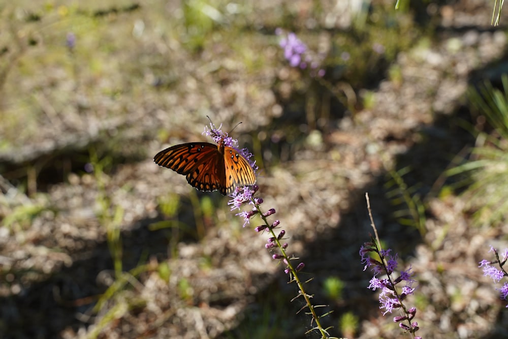
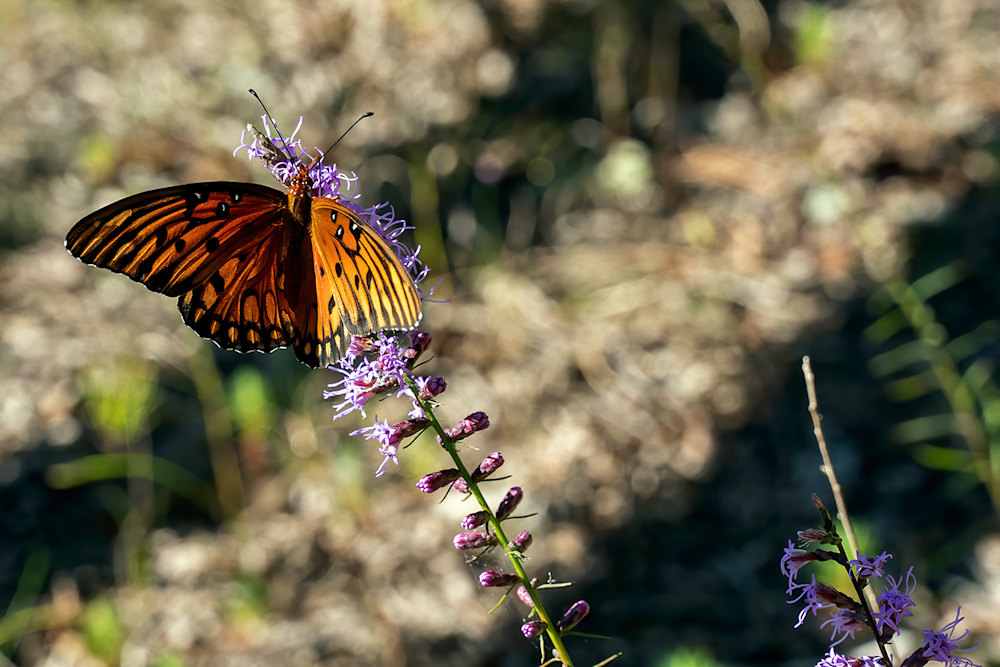
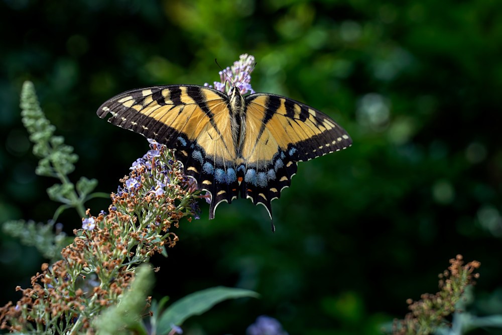
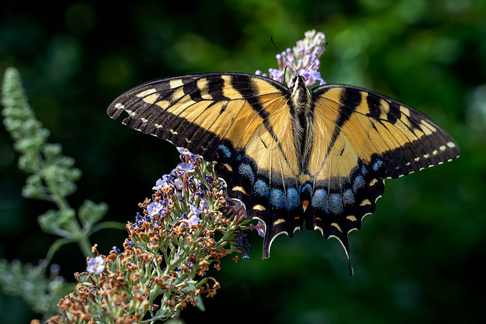
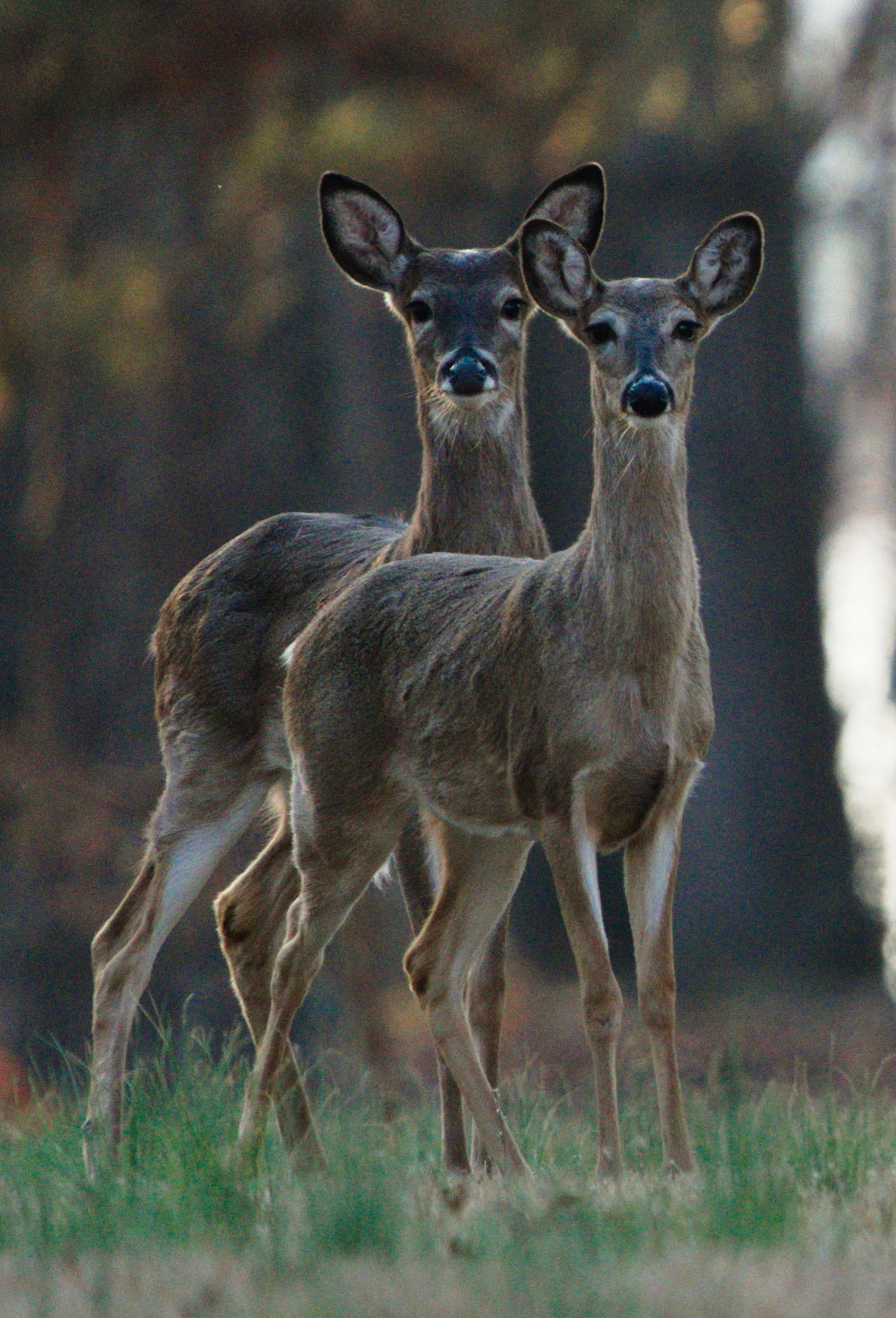
Anyway they have monthly themed contests and next month’s is “Fur and Feathers.” The obvious choice is animals, though I did entertain several alternatives, and maybe will pursue them. Unfortunately I don’t know anyone with a feather boa who wears fur and would be willing to be an outrageous model. I wondered about a still life of fish flies or lures since they often use both fur and feathers; and something tells me that my puppies would not be keen on being dressed up with a bunch of feathers. So the obvious choice it is.
I get to put in a black and white/monochrome entry and a color one.
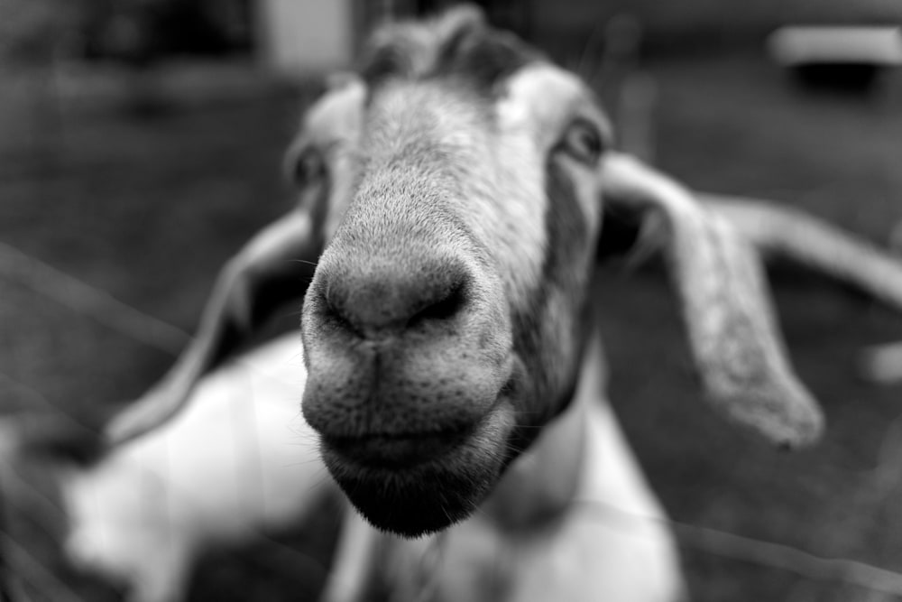
This one is one of my favorites, just because it’s funny.
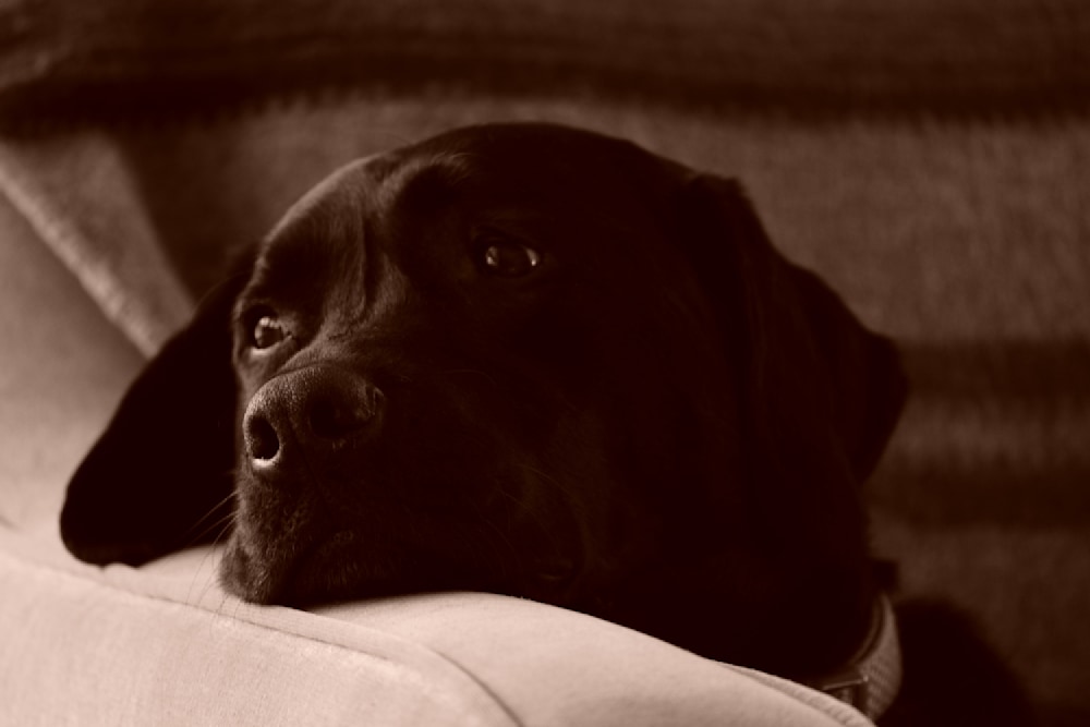
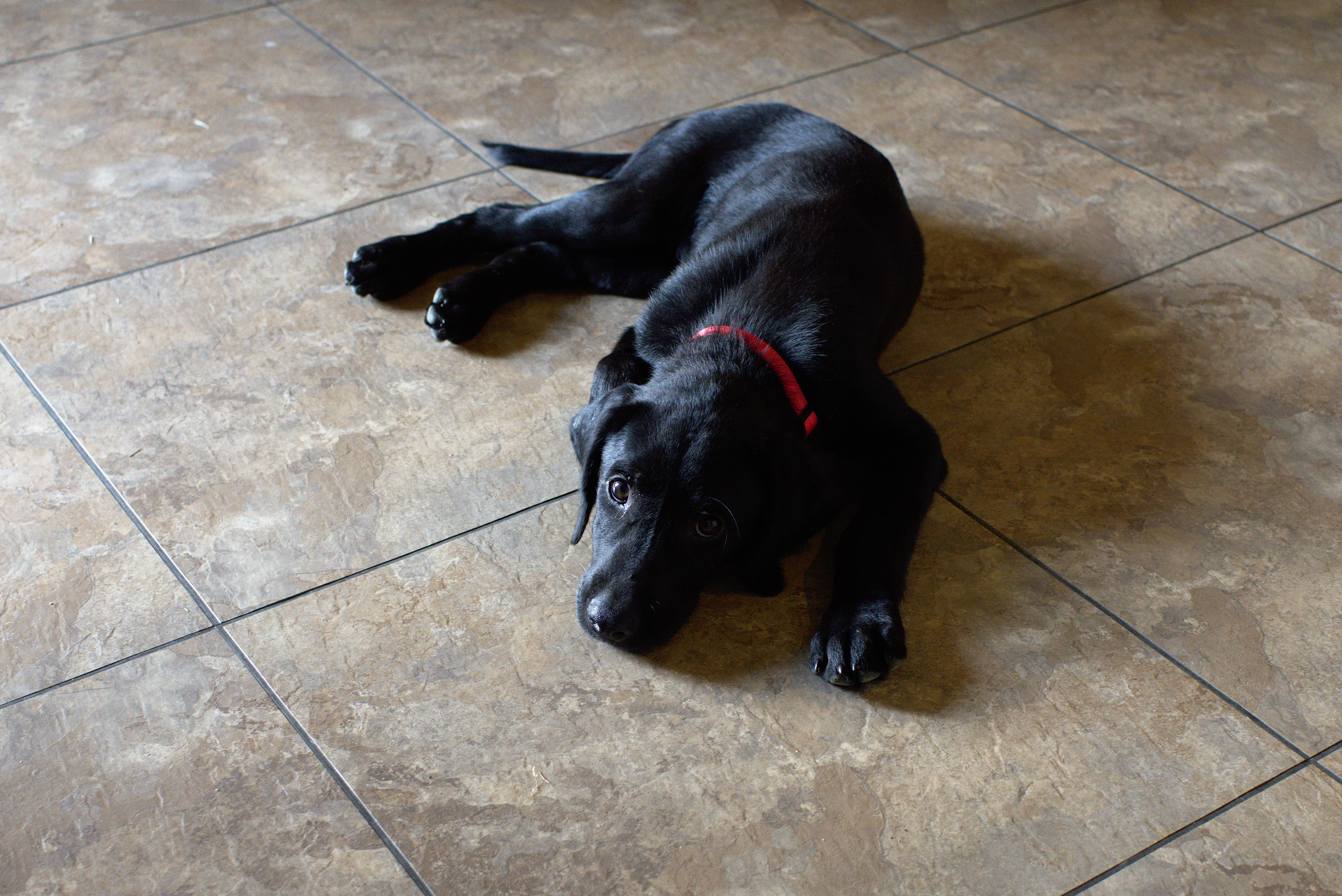
I also like this one of our puppy. It looks like a Julia Ward Cameron work. Either of these will work well enough.
Feathers are a different case.
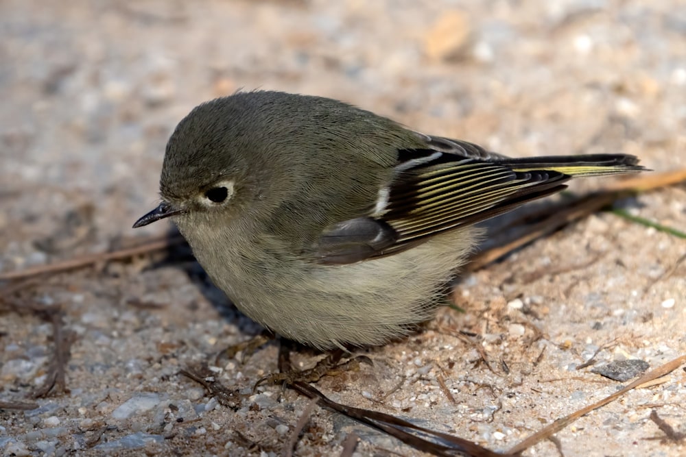
A bird is an obvious choice:
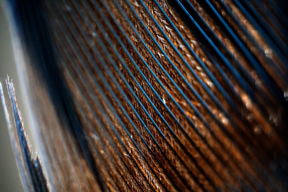
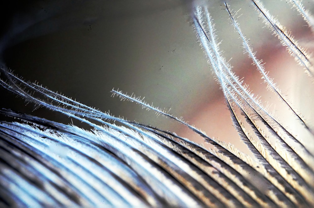
A closeup of a bluejay feather is also possible:
I have a lighter and a darker version of this, but the mid-range is probably best.
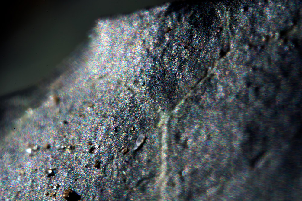
This close up of the edge of a turkey feather is neat, though there are some artefacts from the focus stacking.
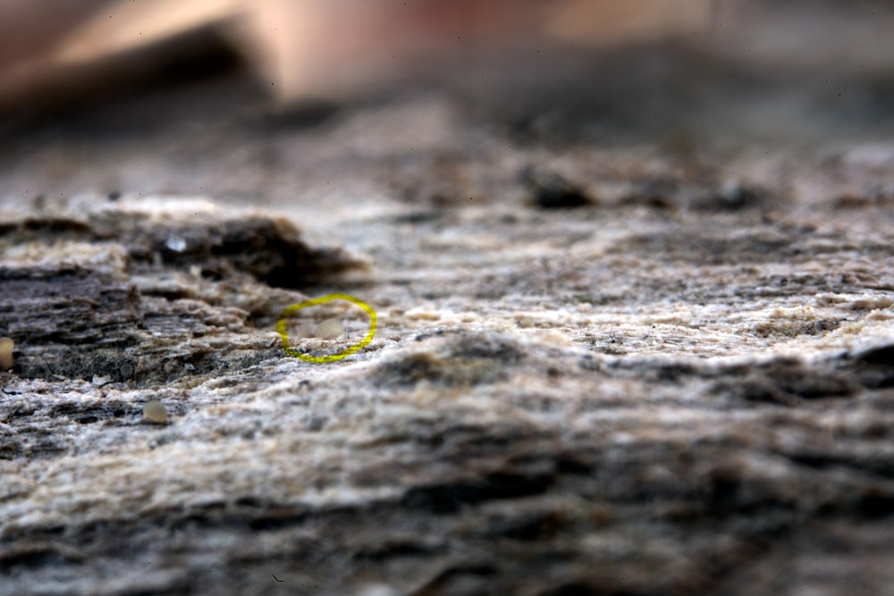
This science-fiction landscape is actually an extreme closeup of a decomposing Oak branch.
Cool, aint it? There’s a tiny mite near the left side and at least three small fungi spore bodies (or possibly slime molds). If you like seeing new worlds, and I do, this is exciting.
I’ll be experimenting with ultraclose photography in the new year. It practically begs for focus stacking – where you overlap a stack of images based on the focus. The lens I’m using is basically a microscope lens adapted onto a mount for my cameras. It’s only a 20mm lens, but you must be within a couple of centimeters to focus. And by the way, you focus by moving the camera, not the lens. So a focusing rail and sturdy tripod are de rigueur so to say. I’m also curious to see what happens when I use extension tubes to move the lens away from the camera body and increase the magnification.
Still there’s a lot to see even with single shots.
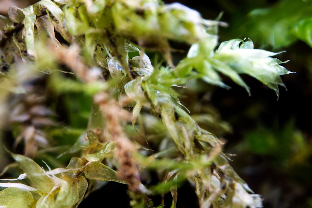
This jungle is a common species of moss:
And English Ivy sparkles with color or perhaps it should be colour, even though it’s dark from the cold.
I didn’t know that and wouldn’t have noticed it with just my eyes.
These images probably won’t make it onto our website, though I’m not sure about the first as it is intrinsically interesting, but drop me a line if you’d like a copy (I’ll probably aske you to sign up for the mailing list though).
One of the big differences between “just snapshots” and art photography is that the artist thinks about what they’re doing, what they’re trying to show, and how to achieve the desired result.
I’ve been reading and studying techniques of composition because … well … that’s one way to learn. The other is way is to go out and shoot, I’ve been doing that as well, and I’m hoping to have meaningful interactions with some of the local photography groups. (We’ll see about that last part, I tried before with one group and had a less than stellar experience. Cliques and in-groups are a thing.)
One book I’ve found useful is Richard Garvey-Williams “mastering composition” It’s inspired me to look again at how I edit images. You can’t always plan out photographs in the wild. You can try, but nature has a way of doing what she wants and the process of observation often perturbs the environment. Shades of quantum mechanics, say what?
The original is pretty, enough, but it’s out of balance and a bit washed out.
Cropping, playing with the image chromatic values (adjusting the image values to remove saturation and then adjusting the midpoint level), and using various trickery to restore the size results in:
This is a vastly better image. The subject dominates the picture and the lines defined by the flowers leads the eyes to it.
2021 has been a heck of a year. Lots of family changes, limited mobility due to Covid, and a difficult combination of on-line and (mandatory) in person teaching.
To the good:
I’m now Emeritus. I was more than a little worried about getting this status, despite a rather decent number of well-regarded publications (>200) and a respectable funding record (Something like $8Million total grant funding as PI, MPI, or Co-PI in the last 20 years).
We’re healthy and in a financially sound position.
We’re vaccinated against that blasted virus. Contrary to right-wing hype, there weren’t side effects and we’re not magnetic or carrying microchips or infecting people with mysterious shed particles.
I helped my ultimate (or possibly penultimate) PhD student to finish their dissertation and graduate.
Our oldest cat didn’t have to cross the rainbow bridge. We finally found what was making him sick, and … well … chemotherapy works wonders.
On the other hand, there are still things to do, ranging from long-term research projects to getting our documents in order.
Still, between using an RV (travel trailer – more in a later post) and vaccination we should be able to get around. I hope we can even visit our UK family and possibly get onto continental Europe.
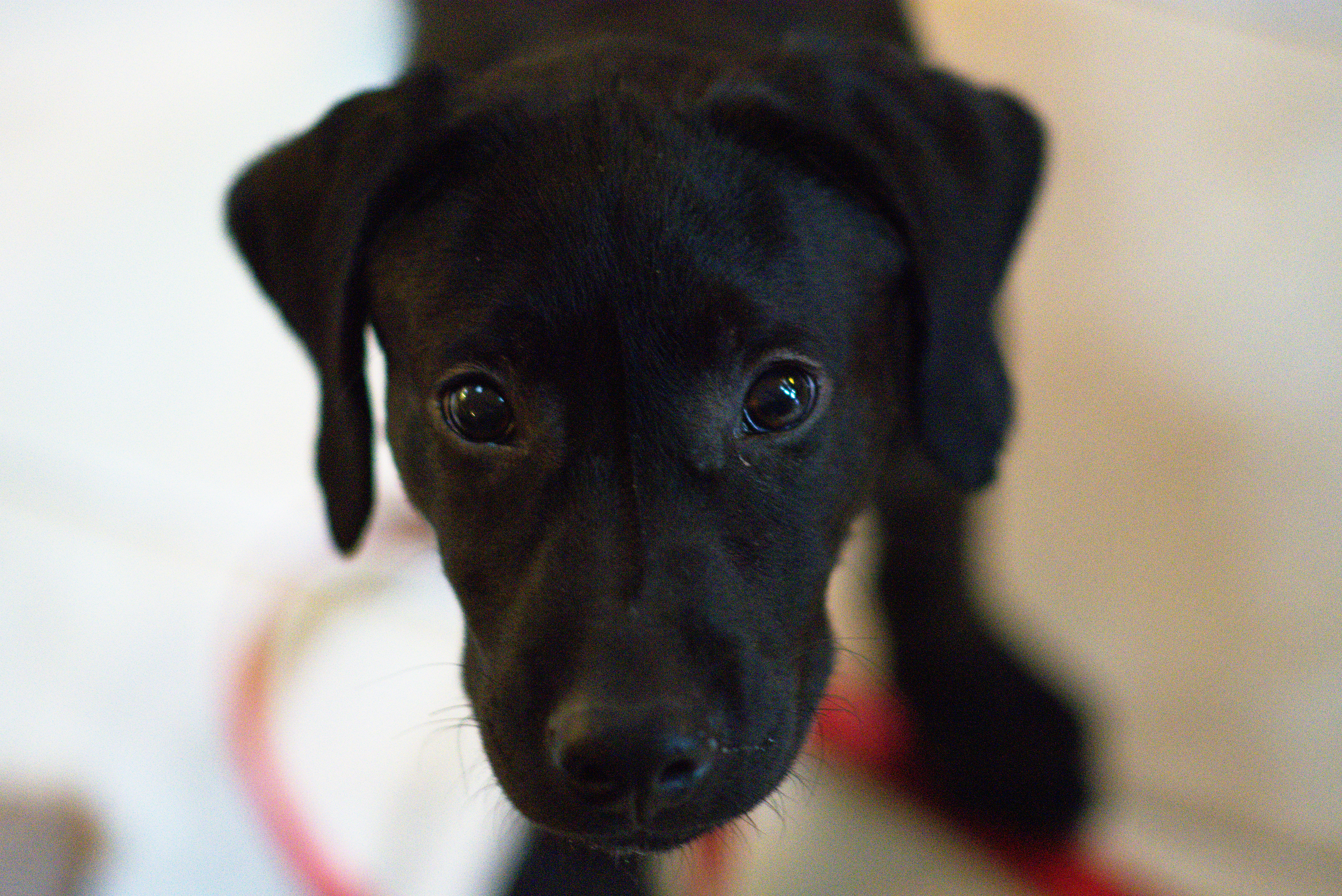
There’s a reason, a very good reason that I’ve been quiescent of late. It’s called a puppy.
Finn Macheiul, our what looks like a purebred Labrador Retriever, was dropped off on the dirt road by our house. (actually he and his brother were.)
You can’t, well I couldn’t, resist that expression.
More to the point, when we took him to the local vet’s, and asked if we should leave contact information, the vet said, “He’s yours.”
Fortunately our older dog likes having another animal around the place. That said, it is a great deal of work training a young dog. Still, he’s healthy, happy, and friendly.
Finn and his brother Tickee playing (Finn has the red collar)
Now back to writing (We have the finish of Regency spies and a new SF series to get out.)
After turning inland we headed to Sonoma – where I forgot to take pictures as it looks much like any other small California town, and we were focused on wine tasting. It used to be free, but isn’t any longer so pick a winery and do a ‘vertical’ tasting. We stayed at the Sonoma Creek Inn, which is the last remaining building from the old hot springs complex. I’d recommend it both in terms of quality and price over the main part of town. (A thousand dollars a night at some of the motels there – which is way way way outside of my comfort zone).
Then we headed down to route 101 and up route 1 to Point Reyes National Seashore. After stopping at the park center to pick up a good map, we headed to Abbott’s lagoon before going to our rental cottage.
We also picked up food. A warning is in order here. There are several small markets along the inner bay in Inverness. Avoid them. The Palace Market in Point Reyes Station is the only one that’s reasonable -both in cost and selection.
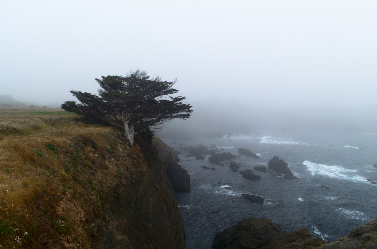
The dunes and beach beyond the lagoon were closed to allow shorebirds to nest and raise their young. Totally laudable, and later we walked to the beach farther North. These pictures are uncommonly sunny – usually the coast is socked in with fog this time of year. More like this view from Drakes’ cliff
After a couple of days exploring San Francisco, we decided to explore further north. Unfortunately, the next few days were predicted to be hot – 110F 38C – in the internal valley so we changed our plans. No lollygagging about in the Napa valley.
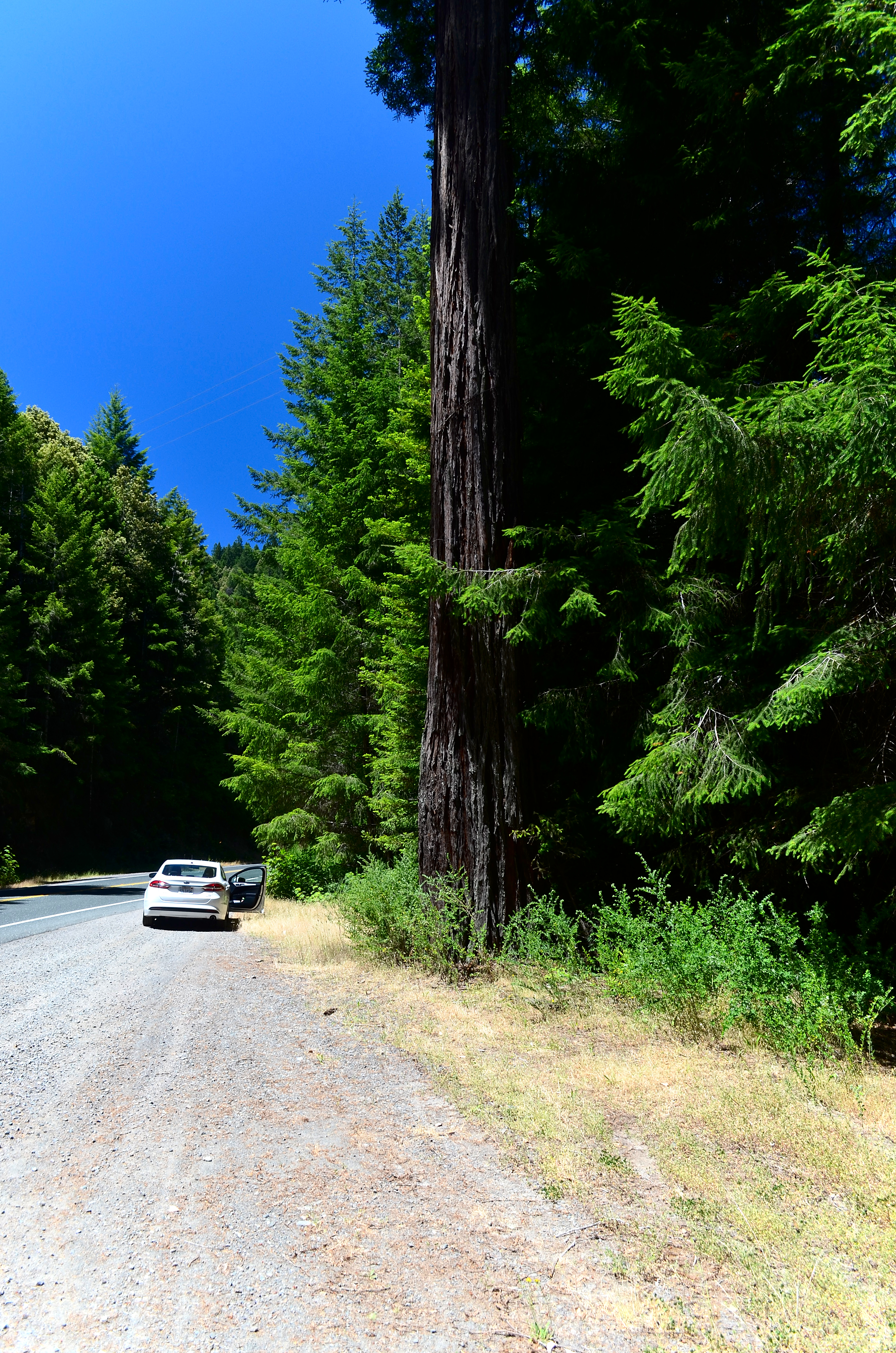
Instead we headed to the coast, up to Fort Bragg. It’s a bit of a drive, up the 101 and then over on the 20, but we could stop in Jackson State Forest and explore the redwoods.
A surviving redwood, with our rental car for scale
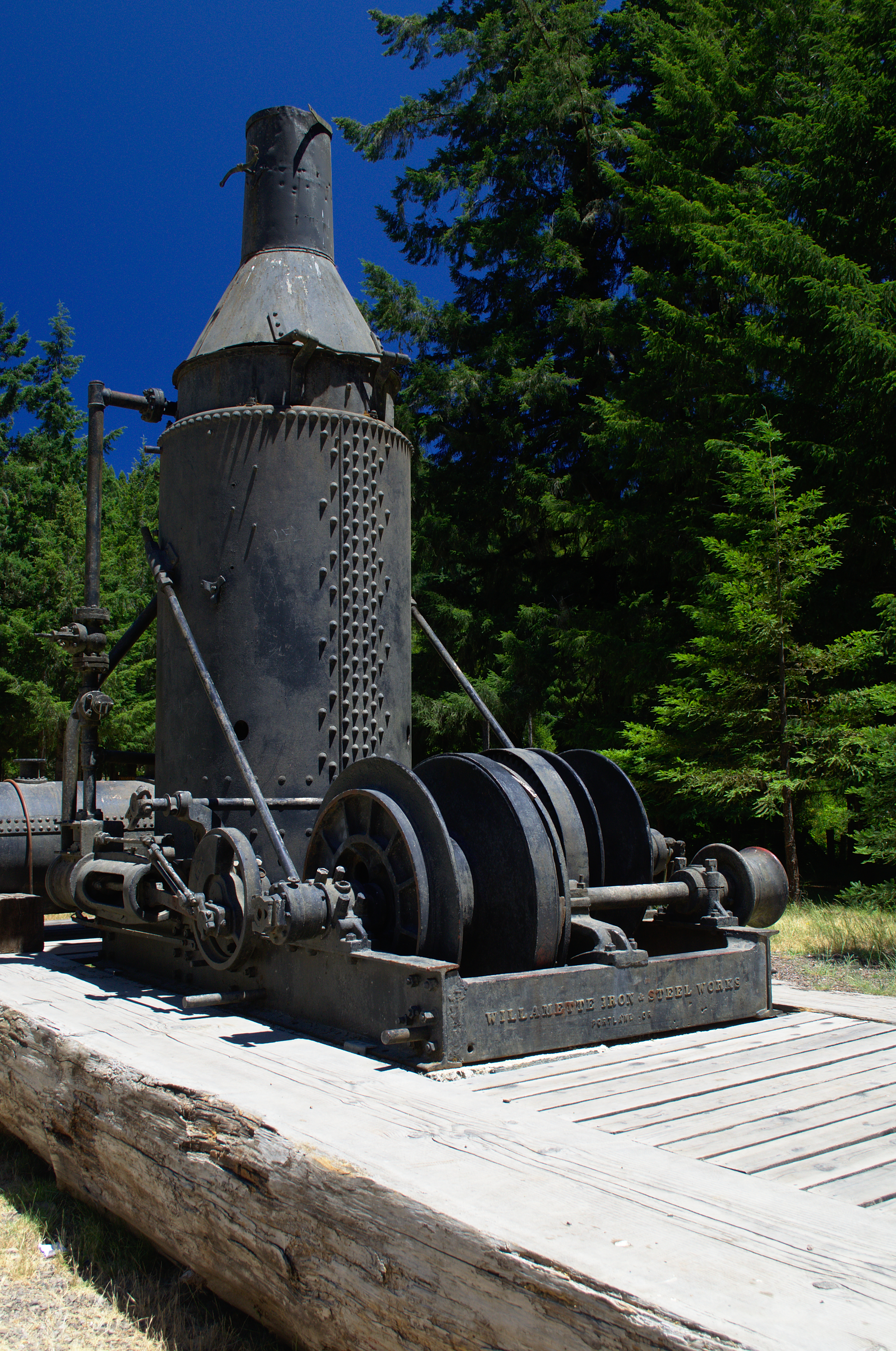
We stopped at a rest area for lunch where there were logging artefacts and some of the worst pit toilets that I’ve seen. The redwoods that have regrown form circles about the one that was removed. Many of the trees that return aren’t redwoods, but douglas firs, so we’ve done a great deal of damage.
A logging steam engines from the 1920’s.
The road to Camp One
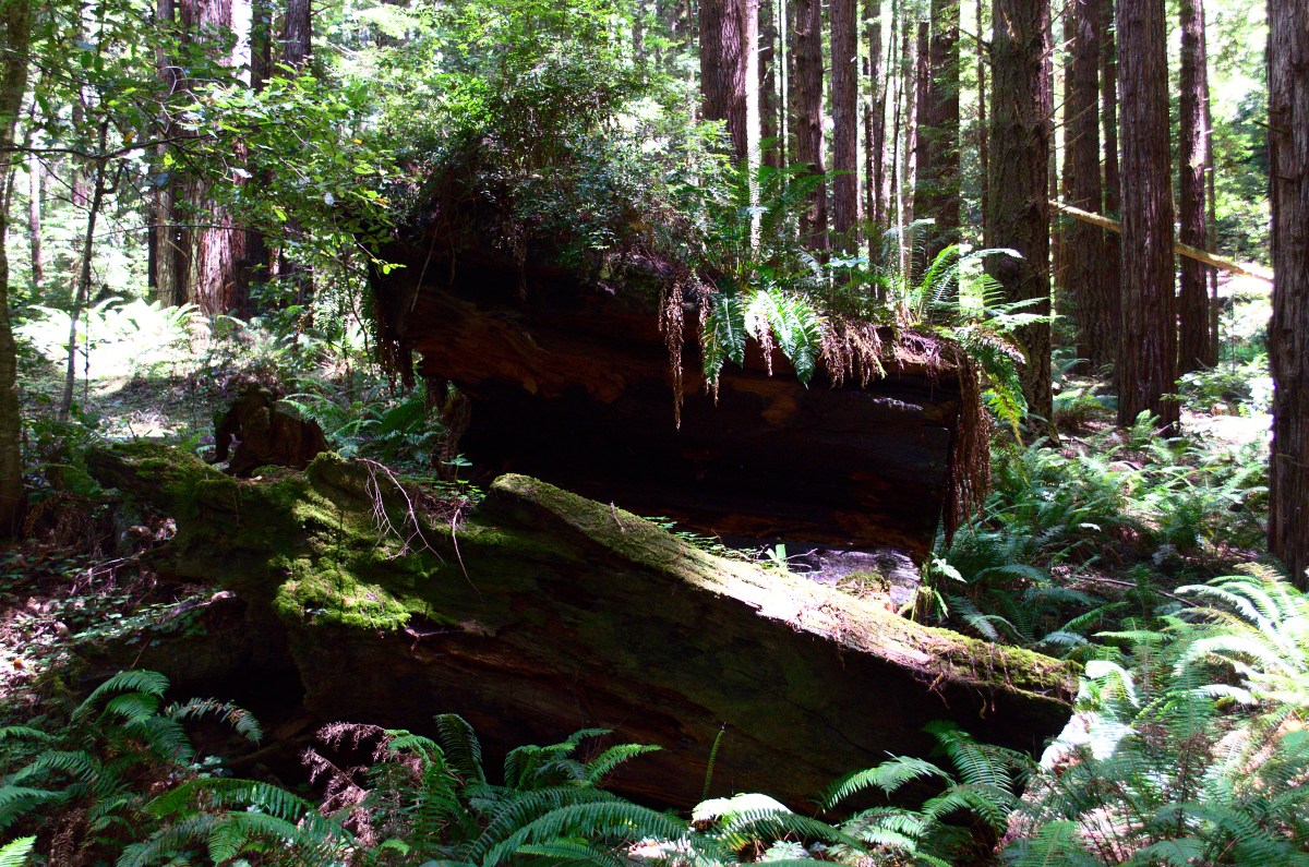
Camp One is a right turn, most of the way to Fort Bragg. You follow a winding dirt road back to a parking lot. There’s a short (1 mile) and long (3 miles) loop up the valley. We took the longer loop to stretch our legs. It’s a bit of a climb on freshly cut trails, but well worth it. The header image shows one of the redwood stumps from this walk.
Regrowing Redwood Forest
The Harbor, on the way up after dinner. Django’s is strait in front of us
Fort Bragg is nothing much to speak of. We stayed at the Hotel 6, which had the dual advantage of being the least expensive motel and an open room. It was a choice between eating at a glorified fast food place or going for a walk. We, of course, chose the walk and found Fort Bragg harbor to the south. Live music echoed up and we made our way to “Django’s Rough Bar” for some excellent sea food, live jazz, and good beer. It’s named for Django Reinhart, the two fingered guitar maestro and the rough bar at the harbor mouth.
Angry Bastard, an excellent bitter
The next day we’d head down route 1, stopping along the way at the Jug Handle State Nature Preserve and Point Cabrillo. But more on that later.
Another digression, between Monterey (we actually stayed in Marina, but more on that in another post) and Santa Cruz, we visited the Elkhorn Slough State Wildlife Refuge. It’s a great place for birds, in November through early spring, but less so in summer. Still we counted about 15 species, including a couple of new ones for the life list, so I’m not complaining. Rather I’m thinking of an excuse to visit at a better time.
The Center building itself. It wasn’t this nice when I visited about 8 years ago.
The refuge, an old farm, is maintained by the state and in great shape. They will lend you excellent binocculars (Eagle optics), and the rangers are friendly, helpful, and knowledgeable.
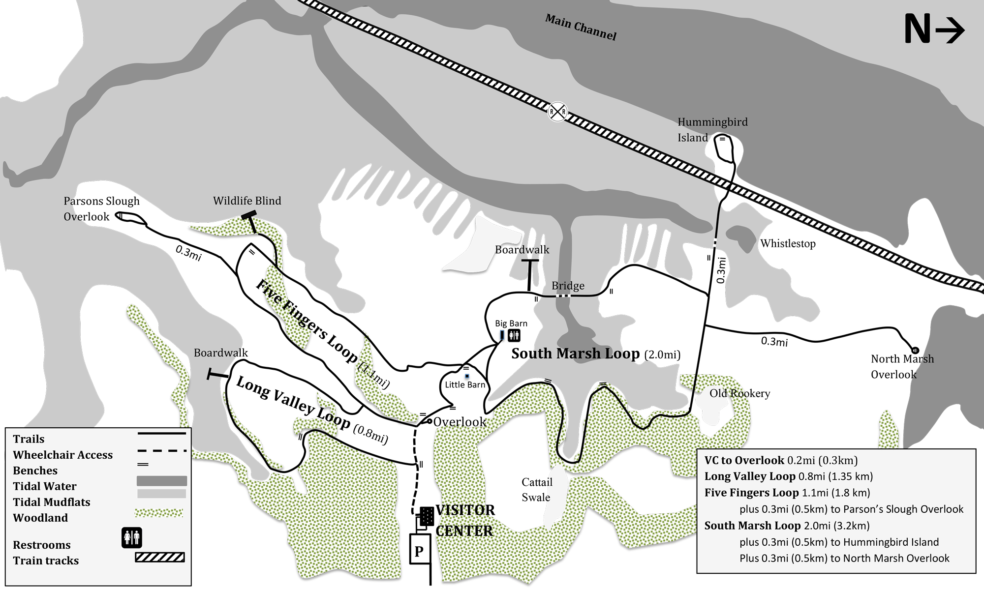
A view of the slough from the South Marsh loop
There are about 5 miles of looped trails over a range of habitat. However, it’s mostly slough, mudflat, and open fields with some oak woods mixed in.
A copy of the trail map that they hand out at the center.
Speaking of oaks, California is in the midst of a slow crisis of sudden death oak fungus, so it’s important to clean your shoes when traipsing about. They also had us brush off any possible seeds from invasive species. Poison oak isn’t an invasive species, and it is present in the refuge (the birds love the berries). One interesting difference between the western variety and its relatives in Georgia is that the California poison oak was already turning red and losing leaves. Still you should be careful about it – unless you like itchy patches of blisters. (Using soap and water within an hour or so of exposure is usually enough to remove the oils.)
Burning off Eucalyptis
However at this time of the year, the non-avian wildlife is worth a serious look. In addition to lizards (mostly fence lizards) and a gopher snake that stayed put for an intimate photograph, there were rabbits, seals, and sea otters. Sea otters!
A curious Gopher Snake.
I repeat sea otters. At least two of them (both surfaced at the same time) and possibly three of them. There is a power line that crosses over the Parson’s Slough overlook. An Egret rookery is at the far side of the slough where it crosses. The sea otters were playing in the incoming tide more or less directly under the wire. There was also a curious seal, who would poke his nose up, now and then. I have to admit I didn’t believe that sea otters came in the sloughs, but I was wrong and the ranger was right.
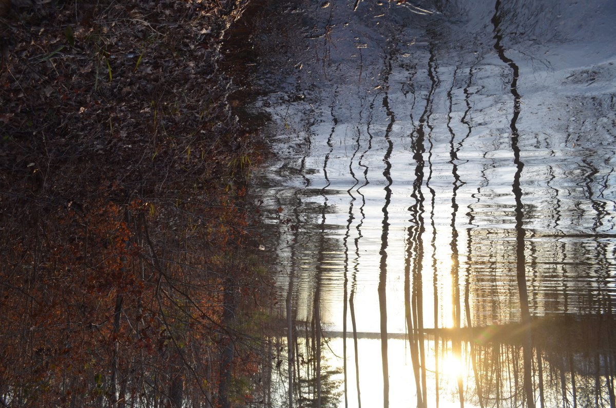
Our day started out sunny, but then the fog and chill (54F, 12C) rolled in, hence the fairly grey photos.
I’ve been trying with various degrees of failure to establish myself as an indie-author. Hence all the literary pointers and similar cruft. Meanwhile, as they say, I’ve had a camera in front of my face since the dark ages (when you processed your own film and made your own prints (and mixed your own chemicals, yum.)) It seems that my photographic and travel posts are the most popular. So that’s what I’m doing as part of a massive re-branding. (At least I don’t have to wait for the iron to get red hot.)